Caution about the map below
1. What the map below does not identify is a key issue:
the states that were covered by the Northwest Ordinances--laws passed by
Congress in 1787 that said slavery would not exist in the Northwest Territory.
That territory then consisted of these states: Indiana, Illinois, Ohio (6 Senators already) and it later consists of 2 more
free states, Wisconsin and Michigan (4 more Senators).
At the time of the Missouri settlement by planters, the North thought the
nation had long agreed that the bottom boundary of the Northwest Territory was
the the boundary between slave and free
states.
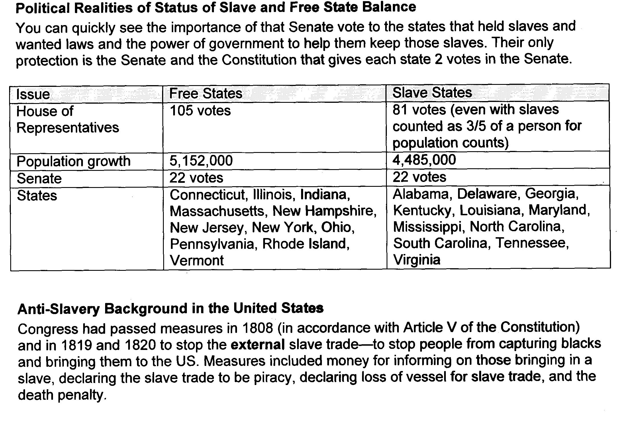
2. What the map below does not reveal is the votes in the North
and the South if those voters and their representatives
vote on slavery. Click on this link so you can notice that the South:
a) Is already outnumbered in the House before the Missouri
Compromise
b) With not having any additional slave states in the Louisiana
Territory, will be outnumbered in the future in the Senate—and thus will not be
able to block an amendment to the Constitution to end slavery.